Moodie
.png)
.png)
Line 
#3042
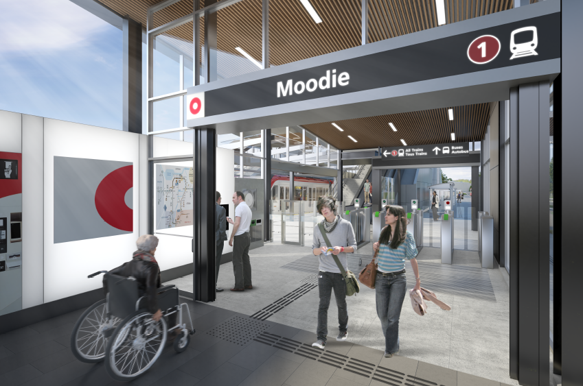
Moodie Station, an existing Transitway stop, will transform into the western terminus station for Line 3. The platform sits between Corkstown Road and the Hwy 417 off-ramp, facilitating seamless connections between buses and trains, and offering you access to the local community.
- For those arriving by car, a PPUDO (Passenger Pick Up and Drop Off) will be available at this station.
- You'll find MUPs and sidewalks guiding you to the station entrance plaza, with bicycle parking conveniently located nearby.
Quick facts:
- Currently under construction, set to open doors alongside the West Extension launch
- Located after Bayshore Station, Moodie Station will become the west terminus stop for Line 3
- The Moodie Light Maintenance and Storage Facility is set to be located just after Moodie station
Station in photos


Station map

Features & amenities

Fares made easy
- Ticket machines with video chat help
- Fare gates at the station entrance

Navigation and wayfinding
- Clear signage and wayfinding
- Illuminated “O” pylon and lantern box
- Service maps
- Free OC Info phone for trip planning help and answers to all your questions
- Map of nearby destinations (within walking distance)

Accessibility
- 2 Dual elevators
- Audible and visual announcements
- Tactile wayfinding tiles & platform edge indicator strips
- Braille/tactile signage

Cyclist amenities
- Bicycle parking
- Stairway bike ramps (runnels) to let you easily walk your bike up and down stairs.

Safety and security
- Transecure waiting area
- Emergency phones
- Platform edge indicator strips
- Video camera monitoring
- Public access defibrillators (in Transecure areas)

Comfort and convenience
- Free Wi-Fi from TELUS
- Public art
- Public washroom
Stops and Service
| Route | Direction | Stop |
|---|---|---|
| 57 | Tunney's Pasture | C, E |
| 57 | Crystal Bay | D, F |
| 61 | Tunney's Pasture / Gatineau | A |
| 61 | Terry Fox / Stittsville | B |
| 62 | Terry Fox / Stittsville | B |
| 62 | Tunney's Pasture | A |
| 63 | Briarbrook via Innovation | B |
| 63 | Tunney's Pasture / Gatineau | A |
| 64 | Morgan's Grant via Innovation | B |
| 64 | Tunney's Pasture | A |
| 66 | Tunney's Pasture / Gatineau | C |
| 67 |
Tunney's Pasture |
A |
| 67 |
Cope |
B |
| 158 | Haanel | E |
| 252 | Cope | E |
| 256 | Bridlewood | E |
| 257 | Bridlewood | B |
| 261 | Stittsville Main | B |
| 262 | West Ridge | B |
| 263 | Stanley Corners | B |
| 264 | Terry Fox | B |
| 265 | Beaverbrook | B |
| 267 | Glen Cairn | B |
| 268 | Kanata Lakes | B |
| 301 | Stittsville / Richmond | B |
| 301 | Carlingwood | A |
| 303 | Dunrobin | B |
| 303 | Carlingwood | A |
| 404 | Canadian Tire Centre | B |
| 406 | Canadian Tire Centre | B |
| 454 | Lansdowne | A |
| 660 | Bell H.S. | A |
| 660 | Innovation | B |
| 661 | Bell H.S. | A |
| 661 | Terry Fox | B |
What’s nearby
Places of interest within 5 km
- Department of National Defence
- Wesley Clover Parks
- Lakeview Park
- Carling Avenue
Also close-by
- Cristal Bay
- Pavilion
- Shirleys Bay
- Dick Bell Park